Rome & Harting

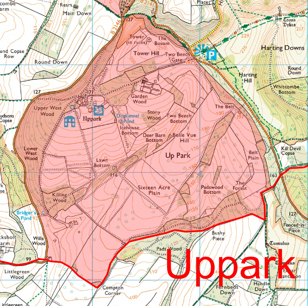
Harting’s first intentional archaeological excavation was undertaken in 1934 by a retired schoolmaster from Fareham, Hampshire, called W A Gilmour. While on a visit to Harting he had been told by the then Rector, A J Roberts, about a place on the Downs, close to the parish boundary, where Roman coins & Samian ware had been found. Having obtained the permission of the landowner, at that time Admiral Sir Herbert Meade-Fetherstonhaugh of Uppark, he began operations. It was not the most promising of starts – the site was running to scrub, and the numerous roots caused him to give up after only a brief exploration without finding any significant features. Undeterred by this disappointment, however, he moved several hundred yards to the north, and began again on another possible Roman site at the head of a small valley in the Downs called Bramshott Bottom. The rest of his career as an amateur archaeologist was to be spent digging this second site exhaustively.

W A Gilmour at Bramshott Bottom in 1937, in the days when people knew how to dress properly while excavating

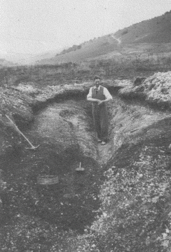
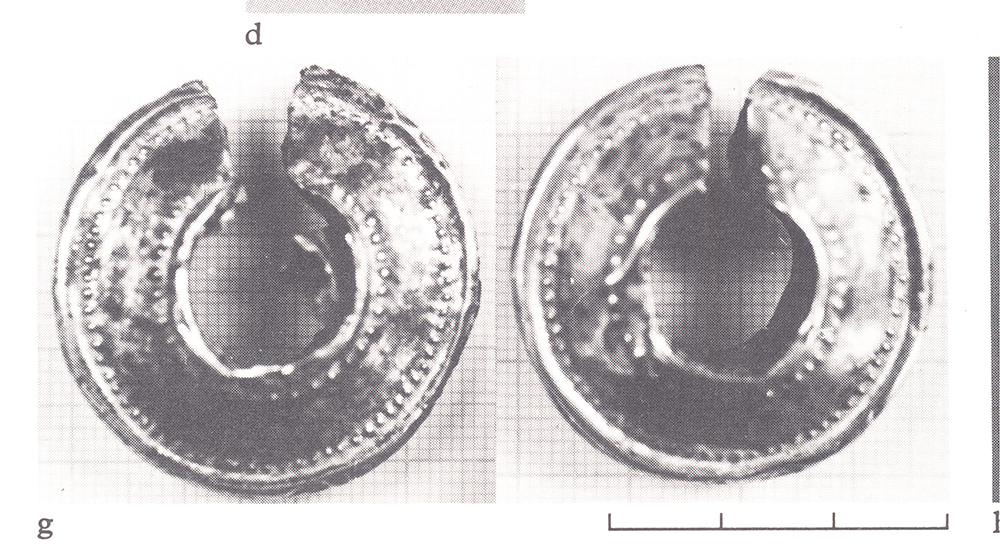
Unbeknownst to Gilmour his activities had been closely watched by a local builder’s labourer named Horace Brightwell. Once Gilmour had abandoned his first site, Brightwell moved in and continued to dig. It is possible that nothing may have come of this piece of archaeological poaching, had Brightwell not found a rare Iron Age blue glass bead, which he took to show the Rev A J Roberts. Roberts then sought to get it published without reference to Gilmour, an almost unforgiveable sin in the world of archaeology, and thus started a bitter verbal war of ownership which was to continue until Gilmour’s death in 1944. Brightwell even went to the length of naming his house “Bead Cottage” in a pointed statement of defiance.

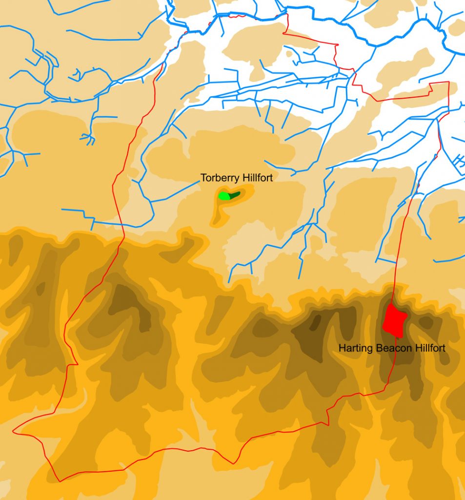
All this is a rather long-winded way of answering one of the questions raised by my previous blog concerning what happened in Harting after the abandonment of the hillfort on Torberry Hill sometime around 100BC. For what Brightwell had found was the first clear evidence in Harting of a Late Iron Age artefact in close association with Roman finds. Gilmour was to go on to find many more, with his site at Bramshott Bottom producing a significant number of Iron Age coins amongst those of the Roman period. And this picture is by no means unique, for the majority of the Roman sites now known in the parish follow the same pattern, with their earliest known artefacts belonging to the first century BC and continuing on well into the Roman period, and in some cases beyond. What we don’t know is whether these sites go even further back, with Middle Iron Age origins contemporary with Torberry Hill, and this uncertainty is because only the two sites mentioned above have been excavated and neither of these was ever properly reported on.

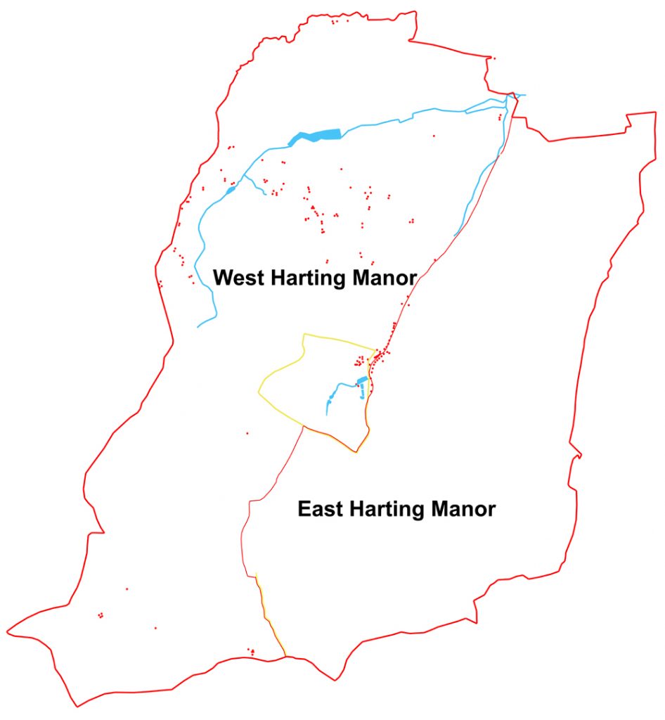
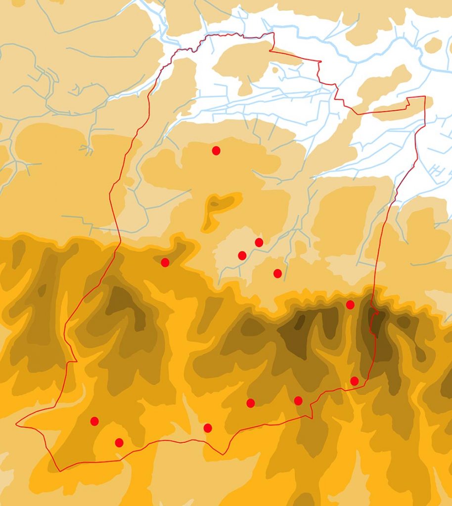
However, our knowledge of Roman Harting is not restricted to merely the activities of Gimour and Brightwell. One of the big advantages of the increase in trade and technology that came with the Late Iron Age and Roman period is that there was a concomitant increase in the amount of stuff that everyone had. This in turn results in an awful lot more rubbish being generated, which then finds its way into the ploughsoil of our fields today. This means that sites of this period are considerably easier to find than those of almost any era of the past, and our map of Roman Harting is therefore much more densely filled. But there are two restrictions on this – first, to find a site it has to have been ploughed or disturbed in some way and secondly someone who knows what they are looking for needs to have been there to look.

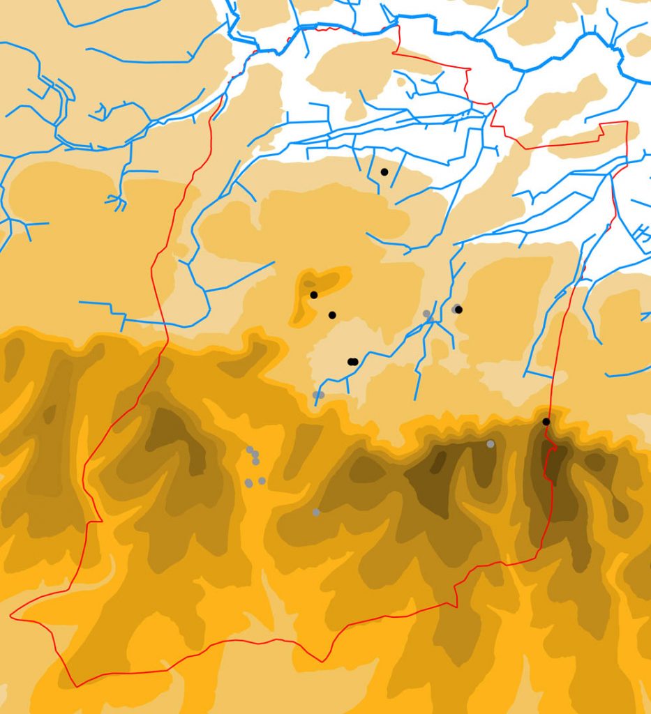
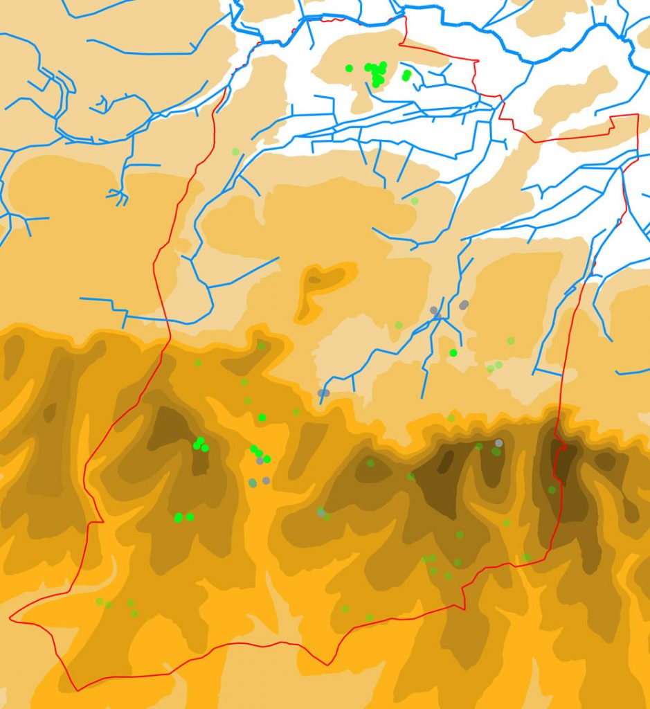
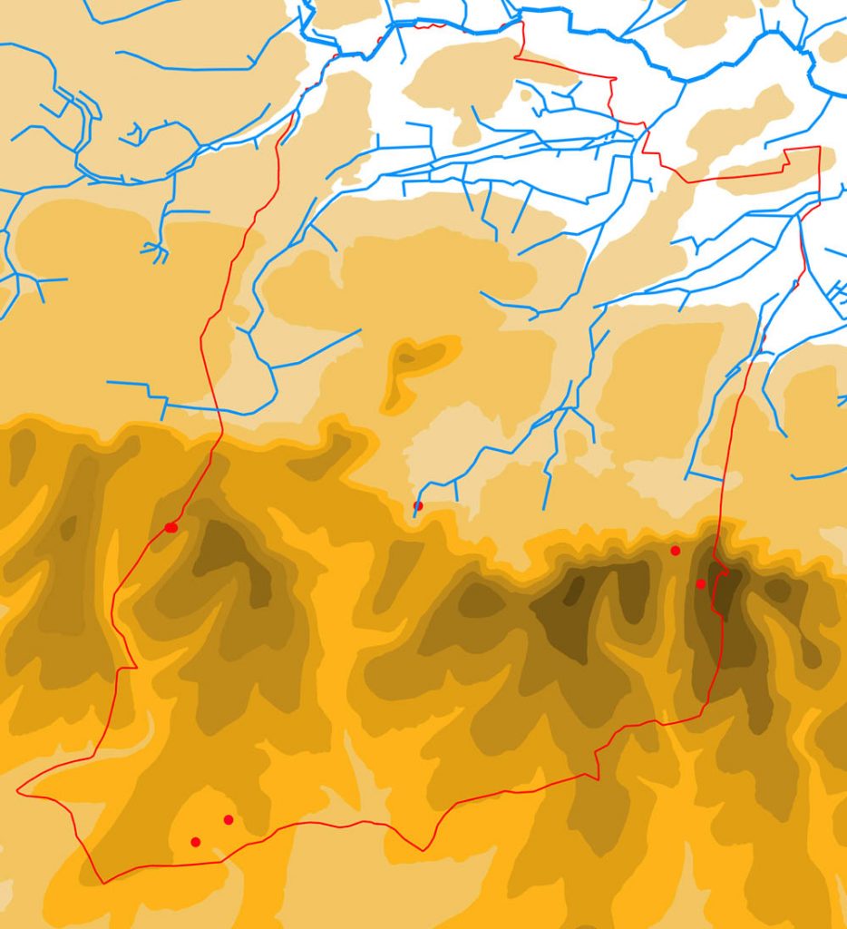
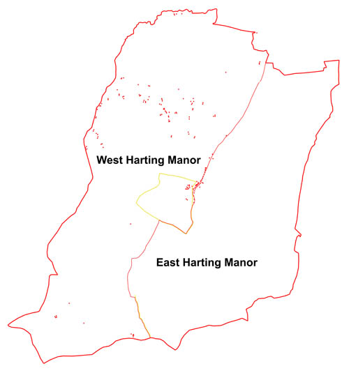
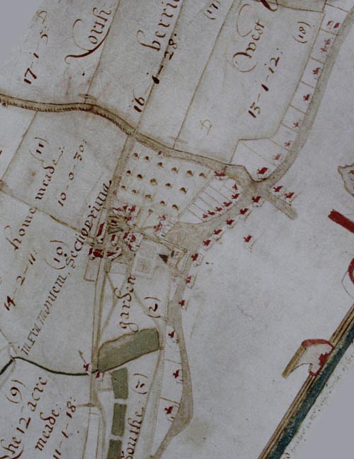
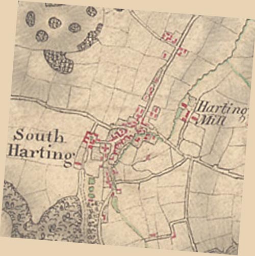
The map below shows all the currently known Late Iron Age/Roman sites in the parish, and their distribution perfectly reflects the results of the restrictions mentioned above. The collection of five sites in the south-east part of the parish are all known from finds made in ploughsoil, mole-hills or rabbit burrows and all were discovered many years ago when previous owners of the Uppark Estate had close links to archaeologically-minded Rectors, or their friends, who were, it seems, permitted to roam almost at will. Included amongst these are the sites Gilmour and Brightwell investigated. The four sites on the west side of the parish were all located by metal-detectorists, at least three a product of large-scale detecting “rallies”. But only some landowners will allow detectorists access, and so such intense seeking activity is patchy across the parish.

Map of Harting parish (outlined in red) showing the known Roman sites (red dots)

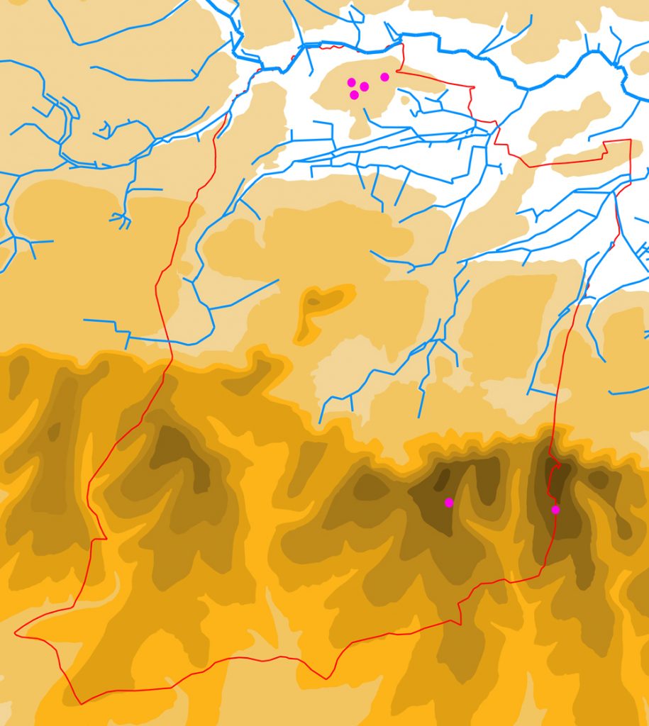
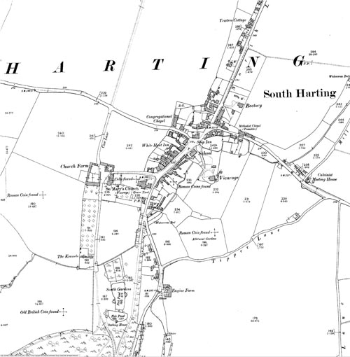
With the exception of Gilmour’s site at Bramshott Bottom, which would appear to be a small farmstead, it is not known exactly what type of Roman site these all are, but they are likely to be either other farmsteads or small villas (the difference between the two is rather imprecise anyway, largely being define nowadays by whether the site has a timber or stone principal dwelling). But the cluster of three sites in the centre of the parish, lying within the village of South Harting, all lay claim to being definately of the latter type, the villa, with varying degrees of probability.

Way back in the 19th century, the then Rector, Rev. Gordon, recorded that he had spotted a tessellated floor and substantial wall within the grounds of what was then the Rectory on North Lane, leading him to assert that this was the site of Harting’s Roman villa. But his claim has never been proven, and the site remains doubtful. Some time later, during grave-digging and again later during excavations for an extension, Roman pottery and tiles were found in the churchyard, suggesting that it was here that Harting’s villa may have once stood, but a small collection of finds a villa doth not make, therefore this too is to be treated with caution.

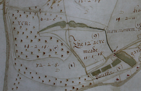
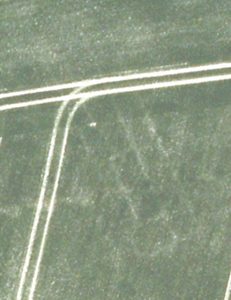
The third central site, however, relies on much firmer evidence. The land either side of New lane has long been known to contain Roman artefacts, ever since Brightwell, whose house “Bead Cottage” lay on the lane, dug rather surreptitiously in the field behind and found pottery, tile and iron objects, before being ordered to stop. But then, in the early 21st century, an aerial photograph taken for reasons that had nothing to do with archaeology, revealed the clear outline of the foundations of what is called a “winged corridor villa”, thereby establishing Harting’s first, and so far only, confirmed Roman villa. To date it has not been further investigated.

Harting’s only known Roman villa – at least the outline of its foundations (courtesy of Chichester District Council)

With the close of the Roman period, Harting enters its own archaeological “Dark Age”, with no known Saxon site lying within the parish. Light only begins to shine once more once we enter the medieval world of the Hussey family, centred on the village of South Harting.

A Tale of Two Hillforts

Harting is in the unusual position of having not just one, but two hillforts dating to the Iron Age. Although before anyone gets ideas about two warring tribes fighting it out on the Downs, it must be pointed out that they were not contemporary. The first one sits on top of Beacon Hill and dates to the Early Iron Age, whereas the second one is on Torberry Hill and dates to the Middle and Late Iron Age.

Map showing the two hillforts, with the modern parish boundary shown by a red line

Very little of Beacon Hillfort has been excavated and so it is hard to be too precise about exactly when it was constructed, what it was for or when it was abandoned. Two attempts have been made in the past to answer these questions, first by P. A. M. Keef in the late 1940’s and early 1950’s, who excavated various small trenches dotted around its perimeter and then by Owen Bedwin in the 1970’s, who put a trench in the hillforts south-east corner and had another look at the entrance which Keef had early identified. Altogether these trenches looked at only about 2% of the whole fort, so not much to go on.

To help with the dating, the excavations produced a handful of Early Iron Age pottery and two rather spectacular gold penannular rings (sometimes called “lock rings” or “tress rings” because it was thought, somewhat fancifully, that they may have been braided into the hair of fair young Iron Age maidens). The rings came from the base of the ditch just beside the hillfort’s only entrance, which lies on its western side approached by a path rising diagonally up the side of Beacon Hill. Somewhat confusingly for those wanting to date the origin of the hillfort, the lock rings fit into a period from about 1000BC to 800BC, whereas the pottery was thought to be much later, but more recent studies of the latter are beginning to close the gap, and so it is now looking like the hillfort may well have its origins in the very late Bronze Age/ Early Iron Age, so around 800BC.

The Harting Beacon lock rings, now held in the British Museum

So what was the hillfort for? There would appear to be two trains of thought – some feel that it is too large (10 hectares altogether), too feebly defended (just one ditch and bank around its circumference) and too thinly occupied, to be the site of a major settlement, and that it was perhaps instead just a large stock enclosure, or a place for the occasional big meeting or market. Others point to the evidence of the artefacts that have been recovered (the pottery, animal bones, spindle whorls, loom weight and quernstones) and of the post-holes that were found in the excavations, to suggest that their must have been some people actually living there, cooking, eating, making clothes, and storing and grinding corn. Ultimately only more digging is going to provide the answer, but I would lean more towards the second school.

The rampart of Beacon Hillfort, looking into its interior (a handy herd of deer providing the scale) from its south-west corner

The date at which the hillfort was abandoned is even less certain than its beginnings, what we do know is that Torberry Hillfort began its life in the 5th century BC, and it seems not unreasonable to suggest that life on the Beacon had come to an end before then. It is tempting to think that the people of the Beacon decided that time had come for a change and that it was they that moved along the Downs a bit, to set up shop once again on Torberry, but we really don’t know, and it is perfectly possible that there was quite a time lapse between the two forts.

Torberry Hillfort is quite a lot smaller than its predecessor and this has meant that a rather greater percentage of it has been explored by the efforts of the archaeologists who put trenches into in the 1940’s and 50’s. Remarkably it was only actually discovered after WWII (Beacon Hillfort had been identified well back in the 19th century) and its finder was a local builder and grave-digger called Horace Brightwell. He it was who dug the first trenches across its rampart and ditch, and proved that it was Iron Age in date. In the 1950’s he was succeeded by John Boyden (and a youthful Barry Cunliffe, later excavator of Fishbourne Roman Palace), who continued its exploration.

What they found was that the hillfort started in the simplest of ways, with just a single bank and ditch dug across the top of the hill, and dividing it into two halves at a slight pinch point in its natural contours. The western part of the hill thus became the “in” part, and the remainder, with its more gentle slope eastwards, the “out”. But this was clearly not enough for those living within it, for shortly afterwards they extended the rampart and ditch to surround the whole western end of the hilltop, defending themselves on all sides. The urge to expand then came over them again in the 3rd or 2nd century BC, when they took in the rest of the hilltop. The final phase came with the construction of a very grand east entrance, composed of a 26m long stone-walled funneled corridor leading to a massive gate. And in the case of Torberry, no one disputes that this type of hillfort was densely settled, similar to Danebury in Hampshire (another of Cunliffe’s sites).

Torberry Hillfort from the Downs, the mist hides all but the top of the hill, where the hillfort lies, the early fort took in the left hand end, the late the whole visible length

Like many of the Iron Age hillforts still going towards the close of the second millennium BC, Torberry seems to have come to a juddering halt around 100BC, for reasons that are not immediately obvious. Contrary to popular belief, they were not all stormed by invading Roman armies, but instead settlement style and location seems to have shifted before the Romans even turned up, with such forts being abandoned in favour of lower lying ground. For Harting, the successors to Torberry are yet to be found, except from a few isolated finds in the fields around. Our next burst of activity being firmly within the Roman period. Of which more anon!

The Living and the Dead

Evidence for the Neolithic in Harting does not extend above a few flint implements – no evidence for Neolithic houses has yet been found, nor have any Neolithic burials been discovered. But this is not unusual, very few of the former are known nationally, and only a limited number of the latter. What we can say is that people were definitely around, since they have considerately dropped a number of their flint tools for us to pick up. The map below shows the distribution of confirmed Neolithic flint axes and arrowheads found within the parish, together with scatters of other worked flints that fall into either the Neolithic or Early Bronze Age. [N.B. The Neolithic began in roughly 4000BC and the Early Bronze Age ended in about 1500BC. The division between the two is constantly being pulled about and redefined, but the shady area in question is around 2500 – 2200BC]

Harting in the Neolithic. The black dots are the confirmed axes and arrowheads, the grey are other worked flints from the Neolithic or Early Bronze Age

Little can be said about Neolithic occupation beyond the fact that they were here, although it is perhaps noteworthy that nearly all the axes come from the lowlands of the parish, possibly suggesting that the focus of activity was there, rather than on the Downs.

The early Bronze Age is dominated by barrows (burial mounds). It is an often stated and only slightly flippant comment, that the Bronze Age seems to have been largely populated by the dead, while the succeeding Iron Age appears to have only consisted of the living. Certainly there is a national shortage of known Bronze Age settlements, particularly from the early Bronze Age, and Harting is no exception, with none known at all. The usual explanation is that in the Bronze Age personal possessions were either few, or leave little trace in the soil, making it much harder to find where they live than in the succeeding Iron Age and particularly Roman periods, when people seemed to like nothing more than chucking their rubbish around for us to pick up in the ploughsoil of our fields. But there will certainly be some Bronze Age settlements within the parish, and the best hope of finding them is probably by looking for concentrations of worked flints in the ploughsoil, which may indicate dwellings beneath.

It is, however, a different story when it comes to death. For Harting, like much of the rest of the country, has many examples of early Bronze Age burial mounds. These largely fit within the period 2200-1500BC, after which, in the Middle and Late Bronze Age, people seem to have given up on the idea of constructing them.

Harting in the Early Bronze Age. The bright green dots are confirmed barrows, the pale green possible barrows, and the grey the Neolithic or Early Bronze Age worked flints

There are two broad types of barrow, the mound variety and the enclosure type. The former, as you might have guessed, consist of a mound piled up over the burial(s), whereas the latter are composed of a circular bank and ditch, defining a central space, within which the burial or burials are placed. There are currently no confirmed examples of the latter within the parish, although they do exist elsewhere within the Rother valley. Examples of the former, however, are relatively plentiful. You will notice on the map above that they seem to major on the Downs, with far fewer in the valley, with the exception of a dense group at the West Heath sand quarry. This might be slightly deceptive, since more are likely to have survived on the Downs than in the valley due to subsequent ploughing – essentially they were more in the way in the lowlands.

The only barrows to have been archaeologically excavated are those at West Heath, so little is known about all the others, save that three burial urns have been ploughed up over the site of one on West Harting Down (x2), and one at East Harting (x1). It is generally assumed that those on the Downs in Harting are constructed of chalk and flint, since that is the obvious local material, but this is yet to be confirmed. The excavated barrows at West Heath were instead constructed of sand and turfs. These barrows formed a compact cemetery, consisting of about a dozen mounds, nine of which were examined between 1973 and 1980. The cemetery forms one in a chain of such barrow clusters, running along the Rother valley between Petersfield and the Arun, all sitting on the south side of the river. They probably each lay within the territory of a separate community, who used the site as a place to inter select individuals. I use the term “select” deliberately, since only a tiny minority of individuals would have been placed under or into a barrow, the vast majority being disposed of elsewhere in much less glamorous ways.

Before leaving the Bronze Age behind (I may return to talk more on the West Heath cemetery excavations in a later blog) the evidence for the Middle and Late Bronze Age needs to be set out. Again we are left with only objects, since there are no settlements known and, since the end of the Early Bronze Age, no dead people either. Rather than flints, however, the objects for these periods are all in metal, either Bronze or gold.

Middle & Late Bronze Age finds from Harting (red dots)

Most of the finds are individual stray artefacts, including knife, sword and axe fragments, a gold ring, and a complete socketed axe. However there are two exceptions: excavations in 1949 into the ditch around the hillfort on Beacon Hill (more on this in a later blog) found two gold penannular rings, probably deliberately buried in a later period; and the other was a hoard containing two bracelets, two axes and a knife fragment, found somewhere in the parish (if anyone knows exactly where, let me know!).

Well, that is it for life up to the end of the Bronze Age – the next step, should I continue chronologically, is the Iron Age, where the local action hots up considerably.

Once Upon A Time…

For this blog I have decided to go back right to the beginning, to the very earliest evidence we have of people getting up to stuff in what was later to become the parish of Harting. The best source of information for these earlier periods is the data held within what is called the “Historic Environment Record” (HER). This database, and others like it, are held by the heritage departments of local authorities, usually at a County or Unitary Council level, but occasionally at District, as is the case for Chichester. Anyone is entitled to ask for the information they hold, free of charge if it is for private research. The entry point for the Chichester District Council HER can be found at: https://www.chichester.gov.uk/article/25592/Historic-Environment-Record-HER

While these databases hold a lot of information about the past, they are obviously limited by what has been reported to them, and that in turn is limited by what has been found. So there is a lot of information out there held by individuals who have never reported what they know or have found, and then there is a far greater amount of evidence that has never been found at all, but awaits either discovery (below the ground), or recognition (above the ground). So while HERs are a great central holding place for data (I would urge any of you who know things, or have found things, to get in touch with them to report it, so that we can all benefit from your knowledge), what they offer is, in their very nature, only very partial snapshot into the past.

The earliest phase of activity that our Harting HER data relates to is the Stone Age, since this is the first of the material-themed ages used to divide up our prehistoric past. The stone age is then sub-divided into the Paleolithic, Mesolithic and Neolithic. “Paleo” is Greek for “old”, “Meso” for “middle” and “Neo” for “new”, with “lithic” meaning “stone”. So essentially you have the “old stone age”, “middle stone age” and “new stone age”. And it was called the “Stone Age” for a reason – the reason being that things were made out of stone, rather than the metals that later ages are named after (Bronze and then Iron). And it is these stone objects, usually made of flint, that constitute pretty much the only evidence we find of the activities of those that made them, for their other possessions were of much less durable material, such as leather, wood and bone (fired clay objects, such as pot, were not known to them)

If I can oversimplify things somewhat, in the first two (the “old” & “middle”) people generally moved around a fair bit, not setting up shop for too long in any one place, as they travelled around looking for sustenance. In the last (the “new”, starting c. 4,000 BC) things settled down, with the development of farming, which tied people much more to one place. This inevitably means that the remains left behind by Paleolithic and Mesolithic visitors to Harting are rather less substantial and numerous than their later more settled successors. And this is reflected in the archaeological data we have.

Sum total of Paleolithic & Mesolithic records in Harting parish in the Chichester District Council HER, shown as purple dots

The map above shows all the records that the HER holds for Paleolithic and Mesolithic activity in Harting parish – not much as you can see. The upper four dots on the map represent a Paleolithic flint handaxe, and three records of Mesolithic worked flints, found at West Heath sand quarry. The lower two dots are Mesolithic worked flints from Round Down and Beacon Hill.

But before we write the neighbourhood off as of little or no interest to our hunter-gatherer predecessors, we need to remember the comments I made earlier about the fragmentary nature of the evidence we hold. I would imagine that there are almost certainly many more Paleolithic and Mesolithic flints from Harting squirrelled away in people’s houses, sometimes perhaps unrecognised for what they are, that have been picked up on walks or while digging the ground (do get in touch if you wish to let me know of any, or just contact the HER). But there will also be a vast number of other flints still awaiting discovery. So taking all this into consideration, it would be very unwise to draw any conclusions about where people might have roamed in those far off ages based upon the six findspots recorded above. Although one point might be worth making, which is that, at least in Mesolithic times, our predecessors were wont to roam both down by the Rother and up on the Downs.

Next time I will move on to look at the last phase of the Stone Age (the Neolithic) and the beginnings of the metal ages (the Early Bronze Age – when barrows ruled the land).

Deer Parks

Deer parks were comparatively common in the medieval period, and were owned by a wide variety of individuals, including the monarch and the titled aristocracy, but also archbishops and bishops, and the more minor gentry. Harting seems to have been particularly well served with such parks, the medieval lords of Harting, the Husseys, possessing three, which together totalled about 20% of the land area of the parish.

The three medieval deer parks of Harting (shaded red). The parish boundary is shown as a red line.

As the name suggests, the principal purpose of these parks was to hold deer, acting as a sort of “live” larder. There seems to have been a fairly consistent ratio of acres to deer, at least in West Sussex, with the parks of the Earls of Arundel containing roughly one deer per acre (1.1 to be precise). We do not currently have the figures for the number of deer in the Harting parks, but presuming the ratio holds true, and that it was a deliberate figure based upon what they considered at the time your average deer in such parks needed, then the total number of deer in the parish would have been about 1,700.

We tend to have fond notions, based on the movies, about medieval lords going out hunting on a regular basis, on horseback and armed with spears, to kill deer in these parks . But it is far more likely that the killing of the deer in these parks was more often done by the park servants, using cross-bows, whenever venison was required. And, to spoil our imaginary picture even more, it is more probable that when the lords did go hunting, they did so as much using cross-bows as spears, and on foot, as on horses. It may well have had a lot more in common with a modern-day pheasant shoot, than a fox-hunt, with the deer being driven past a number of “stands” behind which lurked an aristocratic huntsman with his trusty 12-bore cross-bow.

The medieval Overpark, shown over the modern Ordnance Survey 1:25000 Explorer map © Crown copyright. All rights reserved. License number: AL100036068

The largest of the three Harting parks is what is now called Uppark, but was in the past known as Overpark or Outrepark. This was situated wholly upon the Downs, and contained something in the region of 900 acres, if its extent on the 1808 map is an accurate record of its medieval size. As with all deer parks, there would have been a hunting lodge within its bounds, most probably on the site of the existing mansion, which was itself built in 1685/6. This lodge would have served as the everyday base of the park keeper, but also as the place to stay for the lord and his guests should they come to hunt. In some cases, as at Downley Park, near Singleton, the lord could turn it into a second home on a more permanent basis. These hunting lodges often went on to become farms or even stately homes when the parks were “disemparked” in the post-medieval period, as happened at Uppark. One of the problems with the park at Uppark would have been water, which was obviously a major issue when you had large herds of deer to look after. There are no natural water sources within the park, and so it had to be supplied in some other way, possibly partly through rain-fed ponds, but also manually from wells. There is such a well, know appropriately as “Keepers Well” within the park. It is also possible that the deer were driven into the neighbouring Home Park, which was separated from it only by the current Uppark road, should things have got desperate.

The medieval Home Park, shown over the modern Ordnance Survey 1:25000 Explorer map © Crown copyright. All rights reserved. License number: AL100036068

As has just be mentioned, Uppark bordered onto the second of the Harting Parks, that situated adjacent to the manor house and church of South Harting. This was variously known as “Home Park”, “Old Park” or “Middle Park”. It was a much smaller park, presumably because land on the Upper Greensand shelf was much more in demand for cultivation than that elsewhere within the parish. It extended from the current Petersfield road, up to the South Downs Way, being bounded by the Uppark road on one side, and the road to Foxcombe on the other. Altogether it enclosed about 250 acres, and presumably held a similar number of deer (c.275 on the above ratio). Here a hunting lodge was unnecessary, since the manor house and its outbuildings would have served that purpose, sited as they were just within the parks eastern limit. Water was also not a problem, since, as we have already seen in previous blogs, the main eastern stream of the parish began its life within the park.

The medieval Down Park, shown over the modern Ordnance Survey 1:25000 Explorer map © Crown copyright. All rights reserved. License number: AL100036068

The third and final medieval deer park lay within the northern part of the parish, and was called “Down Park” or “Nether Park” (“nether” being an old word for “lower”). As the name suggests, this park lay in the lowest part of the parish, and certainly did not suffer from water problems. The c.480 deer within its 440 acres would have been well watered by the major West Harting stream and its tributaries, as it meandered through the northern part of the park. Here a hunting lodge would have been required, and it was almost certainly located at Parlour Copse, were a small moat encloses its site. Small-scale excavation of this, back in the mid-20th century, revealed the remains of a timber bridge and significant quantities of roof tiles and pottery dating from the medieval period. This hunting lodge went on to become the main residence of one of the Hussey descendants in the 16th century. As with Home Park, this park may well have also contained a mill, fed by Harting Pond, which itself lay just outside the park to the west. As with all the parks, the idea was that the deer were kept securely inside and not allowed to escape. This was achieved by putting up a fence, called a “pale”, around its entire circuit. The fence was mounted upon a bank, with an internal ditch, to provide enough height to stop the deer leaping over it. Traces of the bank, and occasionally the ditch, if it has not been subsequently infilled, can often still be found around the edges of these deer parks, as is the case with Down Park.

There was a fourth deer park in the parish, but since this was not formed until the 17th century, it is not covered by this blog. It was located on the Downs in the south-western corner of the parish, and surrounded the late 17th century mansion of Ladyholt, once the seat of the Caryll family, and the rival of Uppark, but sadly demolished only a century after its construction.

The Naked Landscape

Writing on water for the last blog post has got me onto thinking about the landscape more generally. A good way to get your head around how a particular locality might have been lived in over the centuries is to strip out all the works of mankind and start again with a blank canvas. The bare bones of a landscape are essentially the topography (i.e. the hills, valleys, plains etc.), the water (springs, streams, rivers) and the geology (what is beneath the ground). Everything above that, particularly in an intensively inhabited place like England, is going to be either created or planted by people.

I find the easiest way to do that is to get hold of an Ordnance Survey Explorer 1:25,000 map (the common walking map) which has the contour lines marked on it, and then just trace over the contours (you can do this digitally or manually). That will give you the topography. You can then also trace over the springs, streams and rivers, which will give you the water. For the geology, we are blessed with the British Geological Survey, whose website contains a “Geology Viewer” which plots all the different geologies in the UK, and you can again just trace them off as appropriate (http://mapapps.bgs.ac.uk/geologyofbritain/home.html?)

When you have finished doing this you will end up with something like this:

Topographic map of Harting parish (outlined in red), showing the contours, water (the blue stars are springs) and geology (boundaries marked in purple)

This exercise presents you with a picture of what the first settlers would have encountered, when they turned up, in terms of the “base layers”. Obviously the vegetation above is not so easily demonstrated, since we simply do not have enough data to be certain of what it looked like. The traditional view was that the whole lot was covered by trees, before man came and cut them all down, but voices have been raised to question this, and it is not impossible that the landscape was in fact rather more varied, with potentially quite large open spaces grazed by herds of animals.

Returning to the three elements of our base map, we will start with geology. Harting, like many of the Sussex parishes, has a wonderfully mixed collection of geologies, with the chalk Downs in the south, sloping steeply down to the shelf of Upper Greensand upon which the villages of West, South and East Harting sit, which in turn dips down to the Gault Clay, with Nyewood upon it, and finally the Lower Greensand, through which the River Rother meanders.

Each of these geologies has its own characteristics, but the main interest for us is those that effect what people do. The chalk is well-drained, with generally thin, easy to cultivate soils. The Upper Greensand is moderately well-drained (there is a varying clay content) and the soils are more fertile. The Gault clay is generally pretty horrible, being too wet in winter and too dry in summer, because of its poor drainage. The Lower Greensand is well-drained, and of middling fertility.

A glimpse at the Google Earth aerial photos will give you a pretty good idea of how farmers now use these different soils, so you will see mainly pasture over the highest Chalk slopes and over the Gault Clay, and then mainly arable over the Upper Greensand and lower southern chalk slopes. The Lower Greensand is slightly more mixed, with some arable and some pasture. While we have to make some allowance for improved methods of ploughing and more effective fertilisers, modern use is not a bad guide to past use, and it seems likely that back in the day cultivation followed roughly the same pattern. The one exception seems to have been that the thin chalk soils on the upper slopes of the Downs were more heavily used for cultivation, probably because they were easier to plough, but we will return to that in a later blog.

It is striking also to note that the vast majority of settlement seems to have squeezed onto the Upper Greensand shelf, probably because the Downs had no water, the Lower Greensand was too low lying and, frankly, no-one wanted to live on the Gault Clay (sorry residents of Nyewood). Again, this may have been different in the case of the chalk in the further past, as we will discuss in that later blog.

Water we have looked at a bit already, but the map above shows that within the eastern half of the parish, as well as the west, and so you can see the fate of the “east stream”, as it leaves West Harting Manor at the base of South Gardens and makes its way north-eastwards to exit the parish on Dumpford Lane. There is a third stream right up against the parish’s eastern boundary, starting close to the bend in the Elsted road, flowing through Sheepwash Copse and exiting into Elsted parish shortly afterwards. Because of its relatively short length within Harting, it does not have the same significance as the other two streams, which were both heavily exploited, as was that short stretch of the Rother that forms the north-western boundary of the parish. As has been stated, once you hit the Downs, water disappears, and any settlement upon them has to make use of deep wells, seasonal ponds, or simply hard grind in lugging water up the hill.

The final element, the topography, is the most striking. Essentially the parish runs down in a series of steps to the Rother from the north scarp of the Downs, but then slopes down more gradually from the same scarp to the south, over the back of the Downs.

Two key factors are immediately apparent, the first being transport. Put simply, how do you get from one end of the parish to the other, particularly over the Downs. Here the contours can really help in predicting where people might, in the past, have done this. The lowest point over the Downs in Harting parish, for example, is clearly where the current Compton road runs, although the valley it uses does fork as it approaches the scarp from the south, with one arm running down to South Harting, and the other running round the west of Hemner Hill. But I will be looking at roads in another later blog.

The other key factor which the topography throws up is settlement. We have already seen the position of most of the current villages, sitting as they do upon the Upper Greensand shelf. Outside of this, settlement is limited, and there has to be a good reason for it existing elsewhere. For example Nyewood has its origins as a railway hamlet, but you will see that even then, that it sits upon a spur of higher land sticking out into the Rother valley, or in the case of the houses at Durford Mill, they are obviously there because of the mill.

I am sure you can draw many more conclusions from studying this base map youselves – some of which I hope to look at in the future. Do feel free to make comments/suggestions, or, if you wish, requests for the subject matter of later blogs.

Water

Water is obviously a key resource at any point in history, and this blog will focus upon its influence upon the history of Harting. Water obviously matters in terms of domestic consumption, for drinking, washing, cooking etc., but it also was the prime source of power, particularly until the advent of electricity. For water powered mills, and then later iron furnaces.

That part of Harting south of the Downs was pretty much water free, and so here the only solution was either to import it, catch it from the rain, or dig down for it in very deep wells. This is one reason why settlement was pretty sparse in these areas. But north of the Downs there was a fairly plentiful supply, and in particular from two streams that flowed from the base of the chalk. One of these streams flowed through West Harting Manor, and the other largely through East Harting Manor, although the latter also began in the west.

The two streams as traced from the 1632 map of West Harting Manor. The eastern stream can be seen starting within the deer park (outlined in yellow) but soon flows into East Harting Manor and is lost to our 1632 map

The eastern stream starts within the deer park attached to the Manor House of West Harting, just to the south-west of the modern village of South Harting. Its source is a spring running out of a little combe just to the west of The Warren, the water now flowing via a small pond down into South Gardens just below the lowest of the existing ponds there. However the 1632 map shows the spring being immediately dammed into two larger ponds, separated by a path, which then flow down to a building at the end of the now missing fourth pond of South Gardens. It is this building that is likely to be a mill, and probably a mill whose predecessors date back to Saxon times. In the Domesday Book, the reference to Harting includes a grand total of 9 mills, of which this was almost certainly one. The current ponds in South Gardens, also probably spring fed from the highest pond, may well have developed slightly later as fish ponds – the watery equivalent to the living larder provided by the deer park. After leaving South Gardens, the stream crosses the Chichester road and thus enters into East Harting manor, and out of the range of our 1632 map. Its lower course will be discussed in a later blog.

The origins of the East Harting manor stream, showing the spring-fed ponds feeding the mill (the upper shapes shaded green) and the later fish ponds of South Gardens (the three lower green shapes).

The West Harting manor stream originates from a spring near Ditcham, again at the foot of the Downs. It flows under the Petersfield Road (B2146) and through what is now Torberry Farm. From there to the River Rother, where it ends, it has an eventful journey, being dammed at least four times for various purposes.

Nowadays the highest dam is that at Hurst Farm, where a mill still exists, although no longer in use. This mill does not appear on the 1632 map, but is there by the date of the 1st Ordnance Survey edition of 1808. Further down stream there was an earlier mill, confusingly called “New Mill” which ironically now no longer exists. It used to lie in Goose Green, in angle between the road to Ryefields and that to Manor Farm, with the mill building located at the eastern end of a small rectangular pond, and several other buildings forming a small hamlet to the west.

New Mill at Goose Green. North is to the right. The mill is the rather faded building at the right hand end of the pond, with two more structures above, presumably one being the miller’s house.

Further downstream again we find what is now called “Harting Pond”, a much larger body of water. There is no sign of a building on the 1632 map in the vicinity of the pond’s dam, and no writing to indicate what its original purpose was. The most likely explanation is that it was the site of another of Harting’s nine medieval mills, but without further evidence this remains uncertain.

Harting Pond, lying next to the West Harting to Durford road. It is a much larger pond than either that of Hurst Mill or New Mill, but its function is not given on this 1632 map

We are on firmer ground with the next pond, although this time, conversely, no pond survives, but a name does. For on the 1632 map the words “Furnace Pond” are written over the area between channels of the West Harting stream, just as it exits the modern parish and enters Rogate, to the north-west of Nyewood. As the name suggests, this was not the site of a mill, but rather of an iron furnace, or more properly an iron hammer. The buildings of the hammer probably lay at the far eastern edge of the pond, inside the parish of Rogate, with the water backing up all the way to Parlour Copse or even Down Park Farm. Iron hammers tend to work in partnership with iron furnaces, with the latter extracting the ore from the rock and the former hammering it to produce a more marketable iron product. The pair for this hammer lay to the north in what is still called Harting Combe, although it lies now in Rogate parish, for here the site lay over the Weald clay, in which the ore can be found, whereas the hammer is over the Gault Clay, which does not contain ore.

The site of “Furnace Pond” to the north-west of Nyewood, on the border of the modern parish. By the date of this 1632 map the furnace has ceased working

The hammer and furnace were in operation from about 1588-1608, a relatively short period, perhaps suggesting that they were not very profitable, certainly compared to the many others that lay further into the Weald to the east. If you want to see the site of a furnace that lasted much longer and survives much better, then North Park Furnace at Fernhurst is the place to go (they have an annual Open Day in September which is well worth a visit ( http://www.fernhurstfurnace.co.uk).

Shortly after the hammer, the West Harting stream empties into the Rother, just to the west of Habin bridge, by Mizzards. And so also ends this blog ,except to observe once again that water meant power in centuries past, and a power that you could just keep on exploiting, building more and more dams to control and use its flow to power mills and furnaces. And the power was not just in the water, for whoever owned the water could make significant sums of money as a result of selling the produce of those mills and furnaces.

Harting in 1632

The 1632 Caryll map offers us a fascinating snapshot into life in Harting at this time, or at least to half of Harting, since by this date the old manor of Harting had been split into two – West and East. The term “manor” can be a bit confusing, so it is worth just saying a few words about it. Nowadays we tend to talk of the “manor” as being a building, but actually originally it was an area of land held by one authority, who may well have lived in the “manor house”, i.e. the principal house within the area of the manor. Back in the medieval period the “manor” of Harting was the possession of the Hussey family, but when the male descendants of that family ceased in the late 15th century, the manor got split between two daughters and their husbands, and then descendants, so that by 1568 it had become divided into two halves, West Harting and East Harting, with the dividing line running pretty much north-south along the line of the Nyewood – South Harting – Uppark roads. West Harting had become the possession of the Sir John Caryll who had the 1632 map of his lands drawn up, while East Harting was owned by Sir William Ford, whose wife was actually another Caryll.

West Harting manor included all of what we now refer to as West Harting village, together with the western half of South Harting village, which was rather uncomfortably split down the centre of the High Street between the two manors. When you compare the number and spread of houses shown on the 1632 map with those existing today, what is most striking is the shrinking of West Harting, for there was a significantly larger number of houses four hundred years ago, than there are now. But actually, apart from that, there is surprisingly little change in settlement and landscape. The bulk of the population growth in Harting has actually been in the eastern manor, with the village of Nyewood appearing in the 19th century and the growth of eastern half of South Harting in the 20th century.

The two manors of Harting, with buildings shown on the 1632 map as red dots – South Harting is in the centre, and West Harting is the very dispersed spread of buildings in the northern half of the manor

I will return to look at West Harting in a later blog, but for the moment we will stick to the main course, which is the central village of South Harting. This was the location of the manor house itself, which lay just to the west of the current church, on the site of what is now Church Farm. It was, in its time, a very impressive set of buildings, with a large crenellated gatehouse facing onto the High Street. Not only did it have a large private garden, of which South Gardens still retains the name, but it was also set within its own private deer park, which extended westwards to the slopes of Hemner Hill, southwards to the summit of the Downs and northwards to the current Petersfield Road

The Manor House of West Harting, with its “South Garden”, containing four ponds (the northern of these is now empty of water)

As you can see the Manor House was part of a large complex of buildings, which I may discuss in more detail in a later blog, but the main building is the tallest shown, to the west of the church, with the gatehouse, almost equally big, situated to the north of the church. Between the church and the Manor House lies a walled garden, which now forms part of the churchyard, still enclosed within the same wall. The building lying at the south-west corner of the largest pond (the northern one) may well have been a mill, powered by the water held back in the upper three ponds. This building does not survive

The Manor House of West Harting, with its deer park to the west (outlined in yellow)

The deer park was not a large one by contemporary standards, but would have been well stocked with deer, probably numbering in the hundreds. Its purpose was to act as a living larder for the benefit of its owners, and also as a source of gifts to those they wanted to favour. By the date of our map, such parks were losing their original function, and being turned over to agriculture – hence the subdivisions into fields, which would not have existed a century or so before. The park as a whole was surrounded by a fence, known as the “pale”, to keep the deer in, and this fence is still marked on the map, even though the park has ceased to be a proper deer park.

In the next blog we will look at another aspect of the 1632 map.

Maps: Part II

In the last post we looked at how the historic maps of the Ordnance Survey can be used to see what your house, village or town looked like in times past. However, these only take you back to the early 1800’s, and then not in great detail, or the 1870’s, if you want to be able to pick out an individual house. But there are maps that will take you back further, and in some cases a lot further.

The first port of call on our journey back in time are the Tithe maps, produced in the mid-19th century in order to facilitate the calculation of the new monetary tithes that landowners were required to pay, as opposed to the old payments in kind (agricultural produce). These maps cover the majority of the country by parish and are at a much more detailed scale than the one inch Ordnance Survey. Back in the day when they were made, three copies were produced of each map, one went to what was essentially central government (now held in the National Archives), one to the Diocese and one to the parish. It is these latter that are now the most easily accessible, since the majority ended up in Local Authority Record Offices. For South Harting the local Record Office is that for West Sussex in Chichester, and the Tithe map can either be viewed there, or purchased from them on CD. At some stage it is to be hoped that they will appear online.

For some places the Ordnance Survey maps and the Tithe are going to be your only historic maps, but for others a whole new world of mapping can open up, from enclosure maps (as the name suggests drawn up to map the enclosure of common land) to private estate maps and other more random examples. These can be held anywhere, including in private collections, but the most accessible ones are held in public archives, such as the National Archives, the British Library or local record offices. All of these have searchable catalogues of what they hold, so it is fairly easy to find out what maps they might have for your area.

In the case of Harting there are more the ten maps pre-dating the Tithe, but the best of all is one held by the British Library (No. Add MS 20089 A). As you might imagine, the further back in time you go, the fewer maps there are, with only a comparatively small number pre-dating the 18th century. But the British Library’s Harting map is one of these, and dates back nearly 400 years, to 1632.

Extract from a map of Harting, dated 1632, showing the village of South Harting
(British Library No. Add MS 20089 A)

Often these older maps are very colourful and tend to include all sorts of extra decoration and details. They also commonly show the buildings in a sort of 3D, rather than from a bird’s eye view, as modern maps do. The titles that go with them are also often rather long and elaborate, as it is with this map, which reads: “An exact & perfect description & general plan of the manor of West Harting in the county of Sussex wherein are set forth & delivered all the houses, gardens, tenements, cottages, woods & underwoods, wastes, commons, warrens, sheep downs & lands situated, lying & being within the tithing of West Harting belonging to Sir John Carill knight now lord of the same manor” and then it carries on quite a bit longer.

Sadly of all the maps discussed above, and in my previous post, only the Ordnance Survey ones are available to view online, which is not terribly helpful in the present circumstances, when we just cannot get to record offices and other archives. It is to be hoped that some day all these old maps will be scanned and make their way onto the web for all to see.

Maps: Part I

During this time of lockdown I am sure many of us are developing new hobbies and interests, or perhaps finally getting going with one that has been on the back-burner for years. For a lot of people this might be researching the family history, something which is getting both increasingly popular and achievable, with all the on-line resources that are around. But another line of enquiry into the past is to research the history of where we live – our house, village or town. This can be a bit harder, since most people don’t really know where to start and there is no one-stop-shop like Ancestry.com. So the purpose of these first WSA Blogs is to give those who want to have a go, a few pointers in how to go about it.

The best place to start is with maps. The UK is peculiarly blessed with its maps. We have to thank the Scots and the French for our most comprehensive set of maps, for if it had not been for their audacity in posing a threat to the rule of the Georges, we may well have never had the Ordnance Survey. In order to make it easier for us to locate and lock up rebellious Scots and to defend our coast from the Corsican tyrant, maps were drawn up that would eventually cover the whole nation.

The first of these were the old one inch maps produced in the first half of the 19th century, and these can now be viewed on-line at: https://www.oldmapsonline.org/ Once you are on the site, the easiest way to get to the right place is to enter the name of your village, town etc. into the search bar at the top. This can require a bit of lateral thinking, because the search engine does not always recognise every place. For example, entering “South Harting” will take you, for some reason, to South Korea, which is interesting, but perhaps slightly irrelevant. Once you have finished looking at maps of South Korea in the 19th century, you will probably want to have another go. The secret to get to the right place, is to try entering the name of somewhere else nearby, maybe slightly more internationally famous that South Harting, and see if that does the trick. So in my case “Midhurst” is the answer. This will then give you a long list of maps on the right hand side of the screen, but most of these can be viewed better elsewhere, and we are really after the early 19th century one inch maps, so the next thing to do is to press the clock icon at the top and slide the bar from today to pre-1850. This then narrows the list, and at the top should appear the one we want, in this case entitled “Midhurst 8”. If you click on that, you will then be able to make your way to the map itself (it is worth clicking on the “view as overlay” option). You will see the resolution is not the best, but it is as good as it gets at this scale.

South Harting in 1808 from the one inch Ordnance Survey map by Charles Budgen

In the later 19th century the Ordnance Survey started producing what is known as the “County Series” maps, which were much more detailed. These can be viewed at: https://www.old-maps.co.uk/#/. Once again, enter the place name that you are interested in (or the postcode) and up will pop all the maps from the 1st edition (normally from the 1870s) onwards. The search engine for this is rather more effective, so it will usually handle small hamlets and villages.

South Harting on the 1898 2nd edition 1:2500 Ordnance Survey map

These two websites will enable you to access pretty much all that the Ordnance Survey has to offer in terms of maps. In the next post I will go further back in time and look at some of the older maps and where they can be found.