During this time of lockdown I am sure many of us are developing new hobbies and interests, or perhaps finally getting going with one that has been on the back-burner for years. For a lot of people this might be researching the family history, something which is getting both increasingly popular and achievable, with all the on-line resources that are around. But another line of enquiry into the past is to research the history of where we live – our house, village or town. This can be a bit harder, since most people don’t really know where to start and there is no one-stop-shop like Ancestry.com. So the purpose of these first WSA Blogs is to give those who want to have a go, a few pointers in how to go about it.
The best place to start is with maps. The UK is peculiarly blessed with its maps. We have to thank the Scots and the French for our most comprehensive set of maps, for if it had not been for their audacity in posing a threat to the rule of the Georges, we may well have never had the Ordnance Survey. In order to make it easier for us to locate and lock up rebellious Scots and to defend our coast from the Corsican tyrant, maps were drawn up that would eventually cover the whole nation.
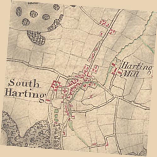
The first of these were the old one inch maps produced in the first half of the 19th century, and these can now be viewed on-line at: https://www.oldmapsonline.org/ Once you are on the site, the easiest way to get to the right place is to enter the name of your village, town etc. into the search bar at the top. This can require a bit of lateral thinking, because the search engine does not always recognise every place. For example, entering “South Harting” will take you, for some reason, to South Korea, which is interesting, but perhaps slightly irrelevant. Once you have finished looking at maps of South Korea in the 19th century, you will probably want to have another go. The secret to get to the right place, is to try entering the name of somewhere else nearby, maybe slightly more internationally famous that South Harting, and see if that does the trick. So in my case “Midhurst” is the answer. This will then give you a long list of maps on the right hand side of the screen, but most of these can be viewed better elsewhere, and we are really after the early 19th century one inch maps, so the next thing to do is to press the clock icon at the top and slide the bar from today to pre-1850. This then narrows the list, and at the top should appear the one we want, in this case entitled “Midhurst 8”. If you click on that, you will then be able to make your way to the map itself (it is worth clicking on the “view as overlay” option). You will see the resolution is not the best, but it is as good as it gets at this scale.

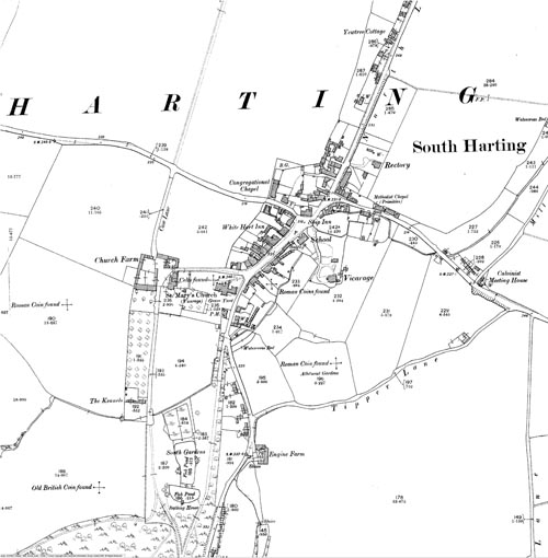
In the later 19th century the Ordnance Survey started producing what is known as the “County Series” maps, which were much more detailed. These can be viewed at: https://www.old-maps.co.uk/#/. Once again, enter the place name that you are interested in (or the postcode) and up will pop all the maps from the 1st edition (normally from the 1870s) onwards. The search engine for this is rather more effective, so it will usually handle small hamlets and villages.

These two websites will enable you to access pretty much all that the Ordnance Survey has to offer in terms of maps. In the next post I will go further back in time and look at some of the older maps and where they can be found.
